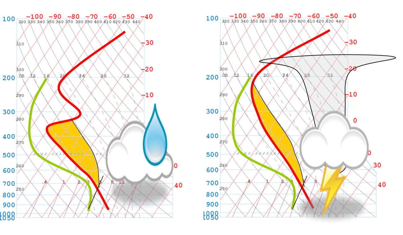
CAPE (Convective Available Potential Energy)
CAPE or Convective Available Potential Energy is energy which is potentially available to further raise an air parcel when it reaches the condensation altitude. It is important to note the word potential, i.e. the energy is only released if the parcel reaches the level of condensation. The biggest CAPE cannot lead to a thunderstorm if only blue thermals form. CAPE values are energy in joules per kilogram (J/kg).
The maximum strength of the uplift (W) can be calculated with the following formula:
Wmax = 0.5 √ (2 • CAPE)
CAPE can be explained best with a thermodynamic diagram. The orange painted area is the CAPE. In the left diagram below, there is a strong inversion present (exaggerated for illustration purposes). Below the inversion, the instability is much bigger than in the right diagram. The surface of both orange painted areas is the same, the CAPE therefore equal. The area on the left diagram is broader but does not reach as high as on the right one: we can expect stronger dynamics from the situation seen in the left diagram. The cloud would reach cumulus congestus size. A thunderstorm development, where the cloud reaches the tropopause, is only possible in the situation of the right diagram.
This proves: a 100% prediction is not possible only from studying the CAPE.
On the Canary islands, the CAPE is normally zero. Because under trade wind conditions, the anticyclone of the Azores is leading into sinking air and forms an inversion as low as 1.000 m AMSL (at 900 hPa).

