Foehn.

The designation foehn originates from the Latin word favonius. In ancient Rome, Favonius was the god of wind. In the past, favonius was also the name of a warm desert wind from north Africa. Today foehn is a collective term for warm and dry downslope winds. Foehn winds are found in many mountains around the world. In the Alps, they are named depending on the direction the wind comes from, e.g. north foehn. For the development of the typical foehn flow, large-scale pressure differences are required. In the published ground weather chart of Europe, the pressure differences develop as a result of a cyclone over England and an anticyclone over Hungary; in addition the embedded cold front reinforces the SW Wind. In distinct foehn situations over the Alps, there is often a bulge found on the isobar chart. Due to its form, it is named “foehn nose”. In this example, there is south foehn, where the wind crosses the Alps from the south.

Humid air from the Mediterranean sea ascends the slopes of the southern Alps. The temperature of the air mass decreases until dew point is reached and cloud formed. In higher altitudes, the air mass flows rapidly northwards over the Alps and subsides on the northern parts. During this subsiding process, the density of the air increases, its temperature rises and any clouds dissolve. Sometimes a foehn hole, a round-shaped region without clouds, forms.As a result of the shape of the Alps, air masses start to oscillate. At the peak of this oscillation, water condenses and the typical foehn lenticularis clouds are formed. On the lee side of the Alps, dangerous downslope gusty winds and distinct rotors form. Pilots should beware of flying on such a deceptively calm and pleasant day since foehn winds can be extremely dangerous, breaking through unexpectedly and producing an extremely turbulent environment. The wind can easily reach speeds of more than 70 kn. At the border of the Alps even more than 100 kn has been recorded. Lift and sink rates in rotors might be as high as 25 m/s.

Foehn does not necessarily form clouds; in fact one third of all foehn conditions do not form clouds. Only the overall weather prediction, wind and pressure values indicate that one has to anticipate foehn.

Moreover foehn can also develop on days with weak wind at altitude. This foehn is named “shallow foehn”. This form of foehn needs a pressure and temperature difference, as well as a path through which the air mass can flow (e.g. a pass). This foehn is not easy to identify and therefore dangerous for pilots. The heavy cold air can unexpectedly flow over the pass and descend to the valley floor, forming gusts and strong turbulence.
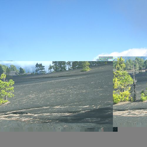
View to the foehn cloud as a result of the trade winds above Cumbre Nueva. View from Llano Jable above El Paso.
La Palma, also named La Isla Bonita or Isla Verde is worth visiting during the whole year!
www.idafe.com ist © Roger P. Frey.
Contact roger.frey (at) idafe.com